

Explore how Geographic Information Systems (GIS) analysts play a vital role in modern forestry, supporting sustainable management and decision-making through advanced mapping and data analysis.
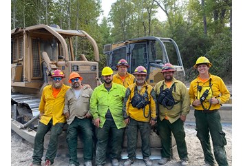
When it comes to forestry and forest management, we often think about the professionals in the woods. But what you may not realize is there is a whole background team that supports “traditional foresters” in the woods. One of the most crucial pieces of forestry support is GIS.
Although in seemingly different parts of the “world” when it comes to technical expertise, field foresters and GIS professionals go together like peanut butter and jelly, like salt and pepper, or even like chicken and waffles (don’t knock it until you try it!).
Each role is crucial in its own regard. Let’s dive into what GIS really is and get an inside point of view from Rayonier’s GIS Analyst Emily Ramirez, based in our corporate headquarters in Wildlight, Florida.
- What is GIS and why is it important in forestry?
- What does GIS stand for?
- What is the difference between Everyday Mapping and GIS Mapping?
- What is the role of a GIS analyst in the forestry industry?
- Why don’t foresters create their own maps?
- Where do GIS analysts get the information they need?
- Meet a GIS Analyst: Emily Ramirez

What is GIS and why is it important in forestry?
GIS is a powerful tool that allows forestry professionals to analyze and manage geographically referenced data. While field foresters navigate the landscape, GIS analysts process and interpret spatial data to guide decision-making.
This collaboration is vital when you think about the complexities of managing hundreds of thousands of acres—millions even, when you look at the entire footprint Rayonier holds in forestland investments!
What does GIS stand for?
If you look up the technical definition of GIS, you’ll read that it stands for “geographical information systems” and is defined as “a computer system that analyzes and displays geographically referenced information.”
But when asked to define what GIS is, Emily says, “GIS is spatial analysis. A coworker once mentioned to me that it is ‘putting data in its place’ and that really sums it up for me: we are creating, managing and editing data associated with spatial places.”
What is the difference between Everyday Mapping and GIS Mapping?
In modern times, we’re all familiar with satellite imagery and “spatial” systems, as they’re the norms for every iPhone, mapping GPS system and even in everyday use through Google Earth and Google maps.
Most professional foresters and natural resource professionals are proficient at deciphering satellite and aerial imagery to be able to navigate their forested landscape.
So what truly makes GIS work differently from anyone simply looking at Google Earth imagery?
GIS analysts take this technology further, combining multiple types of data to create comprehensive maps that provide deeper insights than imagery alone.
Emily shares, “While looking at satellite imagery is very important, looking at imagery does not tell you the entire story. With GIS, you can combine many types of data—including imagery—to be able to build and analyze so many different types of spatial data way beyond just imagery.”
What is the role of a GIS analyst in the forestry industry?
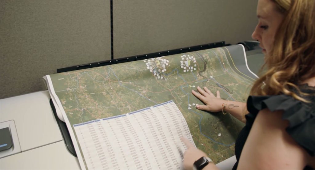
Incorporating all those layers of data into a map system, GIS analysts like Emily can really make a difference in forestry!
By compiling the information foresters gather in the woods, GIS analysts can create a complete, map-based dataset that truly tells a story and helps foresters anticipate and make the best management decisions.
Key Contributions of GIS Analysts:
- Field Mapping: Foresters use GIS-based maps to plan logging operations or silvicultural practices, such as planting and thinning.
- Data Integration: GIS analysts compile data gathered by foresters in the field, creating comprehensive datasets.
- Efficiency: High-quality maps produced by GIS analysts save foresters time, allowing them to focus on fieldwork.
Why Don’t Foresters Create Their Own Maps?
There are times foresters print their own maps out before they hit their logging sites or start their silvicultural management practices.
If foresters print out their own maps, why wouldn’t they just make their own maps and do their own data entry after they gather it from the fields? I mean, they’re the ones IN the woods and would know the layout of the ground better than anyone else in an office setting, right?
Emily helps provide clarification with that too:
“Some foresters do make their own maps, and they’re excellent,” Emily says. “But just as they are experts in the woods, we are experts in mapping. There is a whole art and science behind cartography, and we take pride in producing quality maps. Also, it is about efficiency. I make maps all the time, and I can make a good map quickly. A map made by our department allows the field to spend more time, well, in the field!”
Where do GIS analysts get the information they need?
But you’re probably wondering: how do GIS analysts make determinations on their maps without ever setting foot in the woods?
If all of their work is computer-based, created in an office, and their job is to help the field team spend more efficient time in the woods, how are they making accurate determinations? As we’ll see from Emily, it’s a team effort.
Tools and Technology in GIS
Creating accurate maps requires advanced tools and data sources. Emily highlights some of the key technologies used to gather information for GIS analysts:
- Drone Imagery: Foresters capture high-resolution images of the landscape.
- LiDAR: This technology reveals hidden features under the canopy, such as streams and roads.
- Digitized Field Maps: Foresters communicate directly with GIS systems from the field, capturing real-time data using a tablet.
“We rely on a variety of sources,” she explains. “Imagery is hugely important. We have drone imagery that our own foresters fly, as well as satellite and digital imagery. Also, we have really come to embrace LiDAR. This allows us to see streams, roads and other natural features that we could not see from imagery alone. It really lets us see what’s underneath the canopy!”
And the database GIS analysts like Emily use is constantly being updated by employees who are in the woods.
“Our field foresters utilize GIS technology in the field, particularly Field Maps,” Emily says. “This allows them to communicate with the GIS systems directly from the field, capturing points, lines and polygons for all sorts of events we could not see from imagery.”
So now that we have the basic understanding of GIS and the relationship between field foresters and GIS, let’s really get to know Emily.

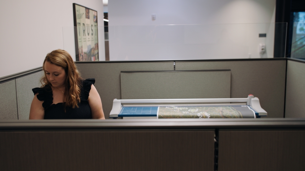
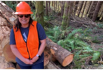
Meet a GIS Analyst: Emily Ramirez
To better understand the role of a GIS analyst, we spoke with Emily Ramirez, who has been with Rayonier for over 10 years.
Emily holds a Bachelor of Science degree in Geography with a GIS emphasis from the University of Northern Colorado. She has extensive experience in spatial analysis, cartography, and data integration.
At Rayonier, Emily has played a pivotal role in advancing GIS applications to support forestry operations and decision-making.
Here, she shares more about her career and experiences in GIS.
Q: What does a typical day look like for a GIS analyst?
A: This is what makes my career so exciting. It really is never the same on a given day. We support the entire company, so one day we may be working with an accounting request, or a solar request, or determining if an acquisition is a good fit for our portfolio. We make maps, answer questions, assist our field users with GIS applications and software, and constantly look at growing our skills to make sure we are on top of the ever changing GIS landscape!
Q: What is the craziest story or memory you have working in GIS?
A: I started my GIS career as an intern at Miami Dade County and they were really focused on bringing 3D and Digital Elevation Models (DEM) data into their systems. I was tasked with creating DEM of the city. I spent almost two days trying to figure out why my DEM was failing and just giving me a flat area. I zoomed into a small area and saw a divot in the landscape. Turns out, it wasn’t failing. Miami is really just that flat!
Q: What’s a real challenge for you in GIS?
A: Having people understand what we do. It is so much more than looking at satellite imagery or Google Earth. We also need to speak up more and show that GIS is integrated in almost everyone’s lives at some point or another.
Q: What’s one thing you wish people knew about GIS work?
A: How diverse the job is. We really do it all, from analysis to cartography. I get to use programming languages, create web and phone applications for our field to use, and use my geospatial analytical skills to answer any question. GIS is a set of skills that can be used in any field, not just forestry. It’s incredibly powerful not only for analysis but for telling a story. A good map is priceless. If you want to relay a message to an audience or just have it as a locating tool, a good map is crucial. The work that goes behind a good map takes a lot of effort!
Q: What’s your biggest pet peeve when it comes to maps and GIS?
A: When the map is cluttered or unbalanced! I understand people want to see a lot of items on a map, but there’s just no way you’re going to be able to tell what you’re looking at if the map has so many layers. Simple is sometimes the best!
Q: Technology is always changing. What has been the best blessing in GIS advancement that makes your job so much more efficient, and what do you think GIS will look like in the future?
A: Using programming languages to automate a lot of repeatable tasks is fantastic. For the future, I think it would be fun to go into more Virtual Reality areas. How neat would it be to be dropped into the forest and create layers based on where you see the streams, plantings, etc.?
Q: What would you advise to someone who is just learning about GIS and looking to get into forestry?
A: Don’t be intimidated by the screen. GIS is using technology to help make foresters more proficient, safer and able to collect valuable data as easily as possible! We rely so much on foresters’ input. We can’t see what is going on in the woods from behind a computer. That’s why we’ve empowered our foresters to implement easy-to-use GIS technology to help create a quality and comprehensive GIS database.
Q: What would you advise someone who is considering a career within GIS?
A: Take a course, a class or even watch some Youtube videos on programming languages! I heard so many times throughout my college career that I would need it, but I didn’t think it was true. Now, 10 years into my career, I love learning and using programming languages! I use SQL probably on a daily basis. It is incredibly helpful.
Interested in becoming a GIS Professional?
If Emily’s story has inspired you to explore a career in GIS, you can learn more about what it takes to become a GIS analyst. Visit the Explore Green Jobs: GIS Analyst page on our website, ForestryCareers.com, to find out the educational requirements, skills and other guidance to get started on this exciting career path.
Article written by Danielle Atkins of Land & Ladies.

Leave a Comment